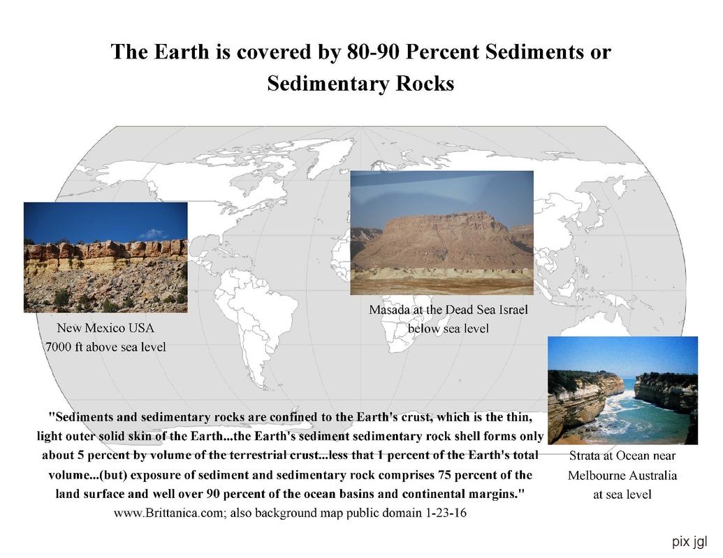
The Crustal Area of Earth Above Sea Level Is Mostly Stratified Rock Probably Laid Down Under A Watery Condition
Vast Gaps In The Geologic Record In Both Time And Area Support Catastrophic Formation Of The Record
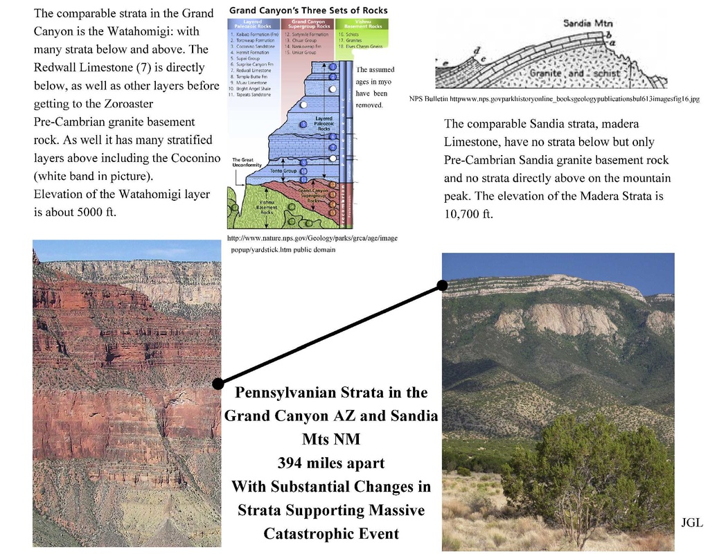
A Comparison of Strata in the Grand Canyon AZ and Sandia Peak NM
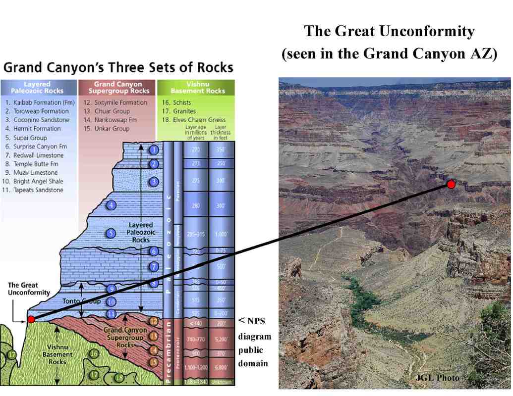
It should be noted that there is a supposed gap, an unconformity, of one billion years between the Pennsylvanian exposed top layers of the Sandia Mts and the underlying Sandia Granite. Yet just 394 miles to the west that same Pennsylvanian layer is deep under overlying strata and has thick layers of strata before reaching the granites below. There is also a (Great) unconformity at the base of these strata, at the Tapeats, interface with the Vishnu granite. These observations are supportive of vast ebbing and flowing of watery layers, with rapid alternating deposition and erosion that varied greatly in these nearby regions.That it was rapid is supported by the fact that there is no erosion of the contact of the Hermit Shale and Coconino sandstone strata-which are supposedly 20 myo different in age of deposition (see below). The data are more supportive of large scale massive and rapid flooding at least region wide. That there are sandstones like the Tapeats and Coconino found continent wide would argue for continent wide flooding (and probably cross continents).
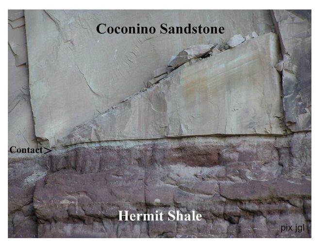
Note: The Unconformity between the Coconino SS and Hermit Shale is NOT the "Great Unconformity"; but is shown because of how such a sharp demarcation occurs between strata that supposedly have a time gap. See information below on the Great Unconformity.
The Great Unconformity: Evidence Consistent with a Great Worldwide Flood.
"The ‘Great Unconformity’ and associated geochemical evidence for Noahic Flood erosion by Harry Dickens
"The Great Unconformity can be traced across North America and globally, including most of today’s southern hemisphere landmasses, along with Western Europe and Siberia—this makes it the 'most widely recognised and distinctive stratigraphic surface in the rock record'...It thus records the onset of the denudation of continental crust, followed by the first major marine transgression (Sauk Sequence) and sediment accumulation on the continents...The Great Unconformity is a clear case where uniformitarianism does not apply. Extensive planation surfaces are not forming today but channel erosion is occurring today.The very high energy erosion of the global Flood would have had the capacity to wear down Precambrian cratons to simultaneously form the Great Unconformity as a peneplaned surface over tremendous areas of the earth..." See CMI article on link below for more information.
"The Great Unconformity can be traced across North America and globally, including most of today’s southern hemisphere landmasses, along with Western Europe and Siberia—this makes it the 'most widely recognised and distinctive stratigraphic surface in the rock record'...It thus records the onset of the denudation of continental crust, followed by the first major marine transgression (Sauk Sequence) and sediment accumulation on the continents...The Great Unconformity is a clear case where uniformitarianism does not apply. Extensive planation surfaces are not forming today but channel erosion is occurring today.The very high energy erosion of the global Flood would have had the capacity to wear down Precambrian cratons to simultaneously form the Great Unconformity as a peneplaned surface over tremendous areas of the earth..." See CMI article on link below for more information.
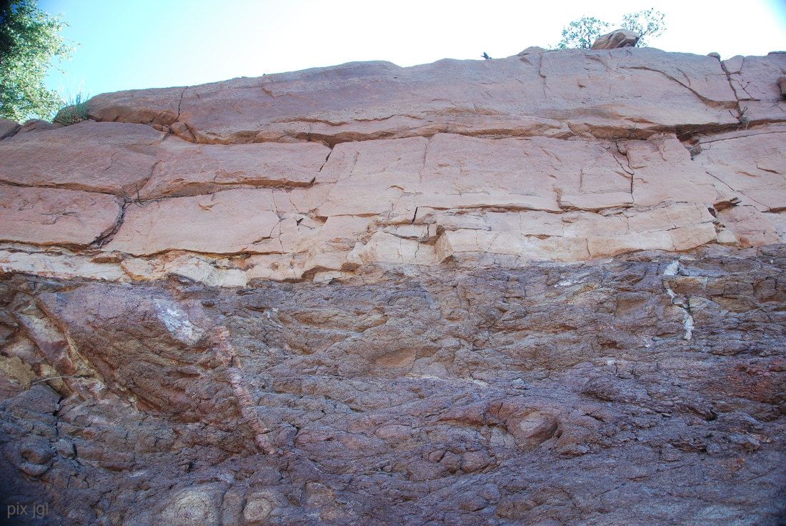
Example of Great Unconformity: Mogollon Rim AZ
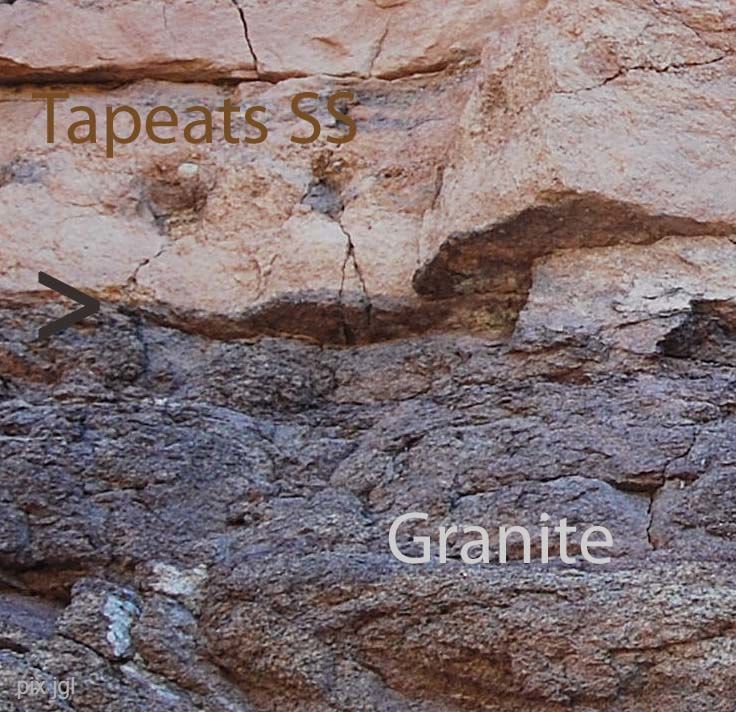
The Purplish colored rock is unconsolidated granite (possibly Vishnu as seen in the Grand Canyon), and the pale pink rock is Tapeats Sandstone which is stratified. There is a supposed gap between the two sections of one billion years-yet the contact surface is as thin as a knife blade (see image below). This observation can be consistent with a scouring of the earth down to the granite layer and then re-deposition of earthy material over vast areas as in the Great Flood. This would not require a large non-observed time gap.
(Pix taken by JGL about 5 miles NW of Payson AZ.)
(Pix taken by JGL about 5 miles NW of Payson AZ.)
Close-up image with text. Arrow at the "Great Unconformity".
Geology in Israel
"Abstract The sedimentary strata that cover most of Israel are an obvious record of the Genesis Flood. A major erosion surface (unconformity) at the base of the sedimentary sequence cut across the Precambrian (pre-Flood) crystalline basement rocks. This resulted from the catastrophic passage of the Flood waters as they rose in enormous tsunami-like surges over the continental land at the initiation of the Flood event. These rising Flood waters transported sediments and marine organisms over the continental land. Many thousands of meters of marine sediments were thus deposited on a vast scale across Israel, rapidly burying myriads of marine organisms in fossil graveyards. Land organisms were similarly overwhelmed by the Flood waters, their remains buried with the marine organisms. The global extent of some of these sedimentary layers in Israel is confirmed by correlations of strata across and between continents, such as the sandstone with pebbles at the base of the Flood sequence, and the massive pure chalk beds at the top. The biblical account of the Flood describes the formation of mountains from halfway through to the end of the year-long Flood event. Thus late in the Flood powerful tectonic upheaval processes overturned and upthrust Flood-deposited sedimentary strata to form these mountains. Simultaneous isostatic adjustments also resulted in restoring continental land surfaces as the Flood waters receded and drained into new deep ocean basins. In Israel this great regression is marked by the end of the widespread “marine” sedimentation and an erosion surface across the country. The subsequent minor local continental sedimentation represents residual post-Flood geologic activity. The end of the Flood also coincided with the commencement of the rifting that opened the Red Sea and the Dead Sea-Jordan River rift valley, as well as the uplifting of the Judean Mountains and the unthrusting of Mt. Hermon." See link below for 43 page article in ARJ titled The Geology of Israel within the Biblical Creation-Flood Framework of History: 2. The Flood Rocks by Dr Andrew Snelling.

