In Contrast:
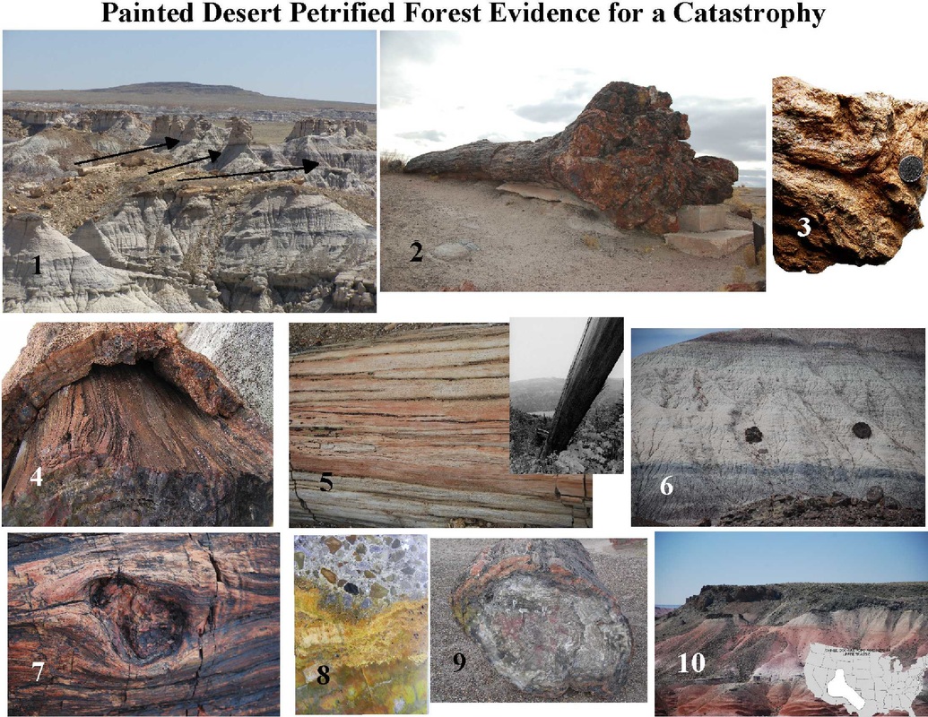
Yet, there the actual data can be more consistent with massive catastrophic destruction. The Chinle Formation (of which the Park is within) covers much of the Southwest US and similar strata are found along the east coast of the US. Images: 1) large aligned tree trunks 30-50 ft long are consistent with significant water flow not meandering; 2) a large trunk with root bulb 4-5 ft in diameter (no extensions of roots) is consistent with the roots being torn off, 3) a small piece of matted material consistent with roots (from outside the PFNP) but representing great matts of similar material found in numerous areas, 4) bark pealing off of the core (pith) of a large tree consistent with excessive abrasive forces applied to the tree and before it could rot., 5) another tree with the bark gone and pith exposed similar to a tree seen at Mt St Helens post volcanic activity, 6) two large tree trunks exposed within a clayey layer both oriented in the same direction consistent with rapid muddy flow, 7) limb socket where a limb had been torn away (not rotten), 8) compaction of tree trunk by a limestone rock matrix not a simple river mud matrix but rather a turbulent muddy/rocky mass, 9) the ovoid shape of a large tree trunk indicated burial under rapid massive pressure, 10) a volcanic layer overlying a portion of Upper Chinle and conformed to it, but no "newer" layers of strata above it. This may be the possible result of massive erosion post volcanic activity. See section Creation/evolution>Geology and the Flood>Evidence for Catastrophic Deposition on website.


 RSS Feed